
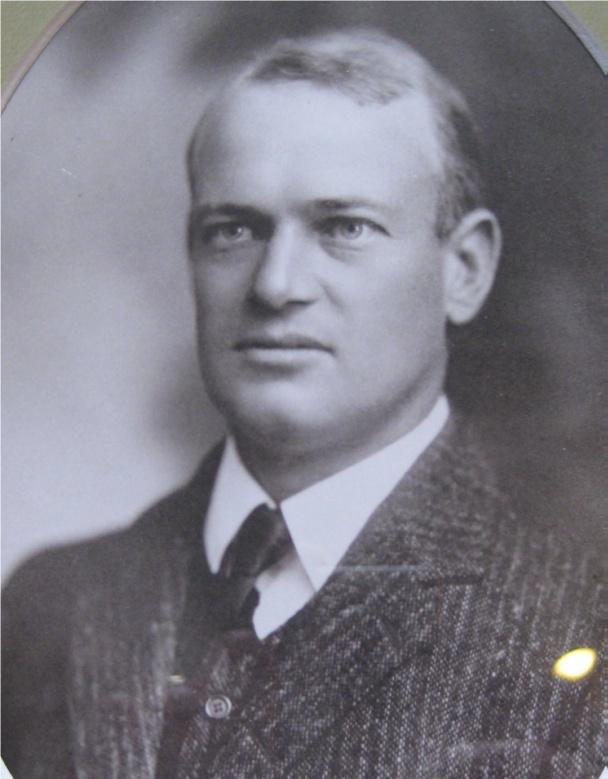
William was born into a prominent legal family who were living at Passey Avenue in Hunters Hill.
| 1913 | Elected as Mayor and Council Alderman of Hunters Hill |
| 1915 | The Moocoboolah district was formed with Bill Windeyer as the District President - Bill had previously been a supporter of the Hunters Hill scouts. |
| 1917-24 | Re-elected as Mayor and Council Alderman of Hunters Hill |
| 1921 | Met Baden-Powell on a ship to England |
| 1923 | Served on the Council of the NSW section of the Boy Scouts Association of Australia |
| 1928 | Primary person drafting the legal work needed to set up the Scout Association |
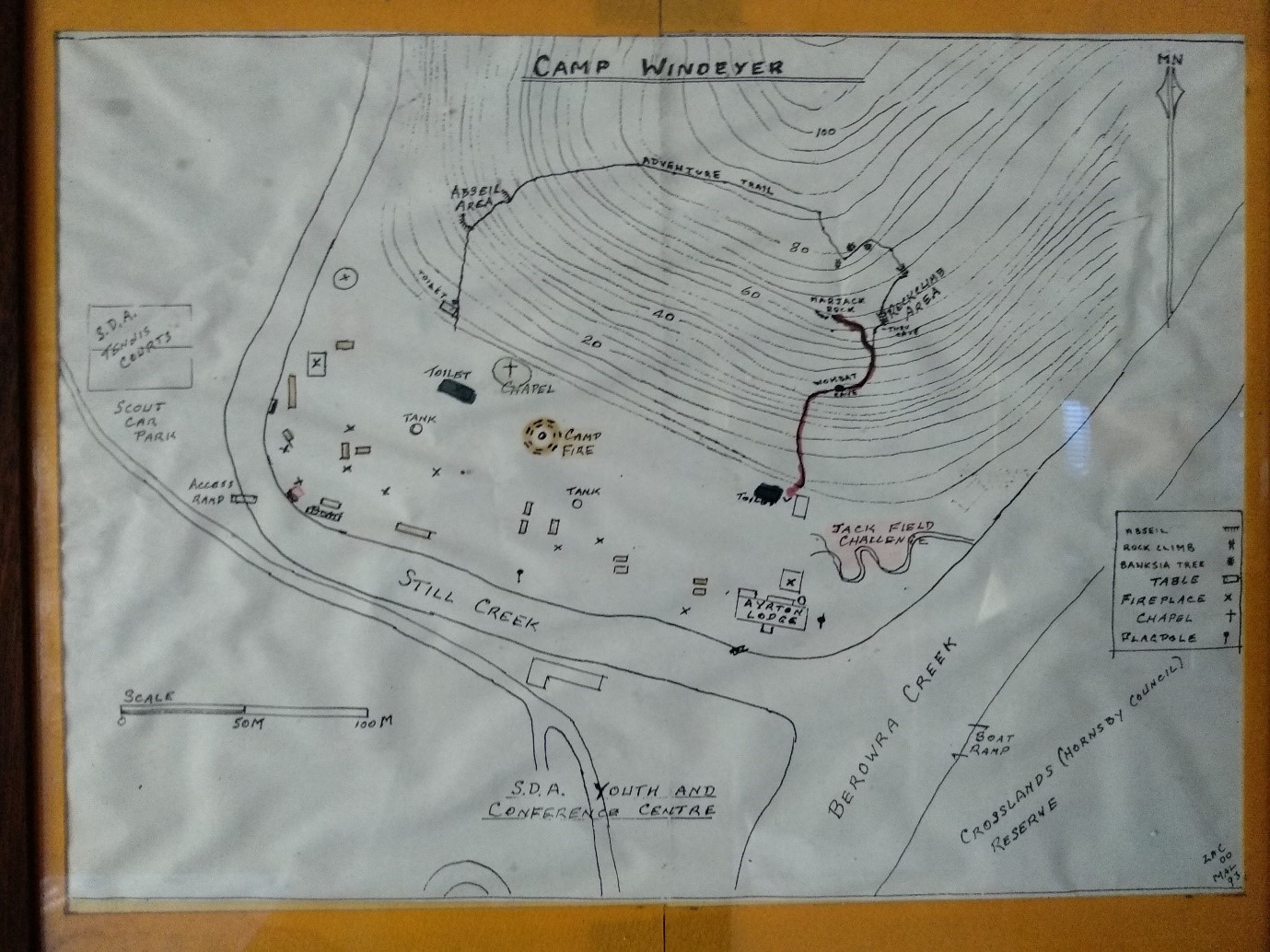
The land for the Frank Windeyer Memorial Scout Camp was acquired in 3 stages.
Bill Windeyer was concerned that the Moocooboolah scouts had nowhere nearby to camp. The closest camp ground was Brown's Waterhole, by the Lane Cove river near North Epping, but it was considered dangerous and the Scout leaders had to be on constant watch to ensure nobody drowned.
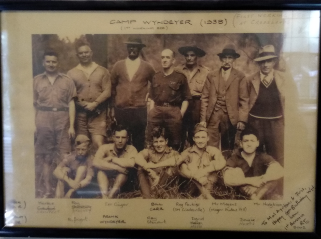
In 1937 Bill Windeyer and a fellow solicitor donated 10 acres of land which Bill owned (about the size of 40 average homesites), to the original Moocooboolah District scout groups reporting to commissioner Bill Carr.
The groups are recorded as 1st and 2nd Gladesville, 1st Ryde and 2nd Ryde (now St. Charles), 1st Boronia, 1st Hunters Hill, 1st Villa Maria, 1st Tipperary (Sea Scouts), and 1st North Ryde.
The Moocooboolah District raised money to buy a further 10 acres.
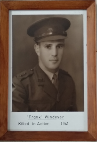
During World War 2, the Moocooboolah District Scout Leader Francis (Frank) Windeyer, was killed whilst he was serving in Tobruk, Africa.
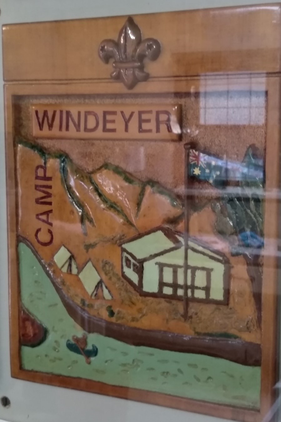
Frank had been a Scout Leader and then the Moocoobolah District Scout Leader when he joined the army as World War 2 began. As a memorial to their son, William (Bill), and his wife Ruby Windeyer gave the Moocooboolah Scouts a further ten acres at Still Creek and asked that the site be called the "Frank Windeyer Memorial Camp", as it is known today…
There was a smaller hut at the camp which was used by the Rovers - the oldest of the Scout sections. The Rovers hut was however riddled with white ants and considered dangerous and it was torn down.

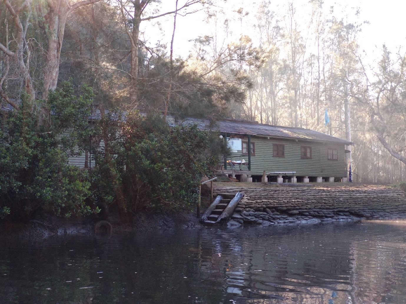
The Camp Committee bought an old hut from Bradfield Park Royal Australian Air Force base. Bradfield Park no longer exists, but it was located on the northern bank of the Lane Cove River in the area now known as Lindfield.
Have you ever wondered how that huge building got from the suburb of Lindfield to the Frank Windeyer Memorial Scout Camp?
Look carefully at the hut when you next visit the camp and you can see where the hut has been cut into sections, so it could be transported by truck to the Seventh Day Adventist camp across the river.
To move the sections of the hut across the creek, 4 large She Oak trees were cut down and trimmed, then 2 trees were placed on each side of the creek spaning from the top of the creek bank down into the centre of the creek. Each of the sections of Walls, roofing and flooring were then unloaded from the truck, slid down the poles on the Seventh Day Adventist side, floated across the creek and then pulled up the Scout side by 20 or so people with ropes. The sections were sorted, stacked and laid out like a giant jigsaw puzzle. Everything went back together and got covered quickly by bolting the roof panels together. The piers holding up the building are big concrete pipes which have been cut to the length required, filled with sand from the creek and then stamped down by a "Dumpy Cub" and capped with concrete.
The original water supply came from a natural spring on the Seventh Day Adventist hillside which was then piped under the creek to a tank at the end of the hut. Everything worked well for a few years until the volunteer fire fighters did a controlled burn of the area and burnt out the plastic pipe line. After the fire the campground was joined to the Sydney water supply.
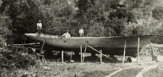
The site on the other side of the river at the end of Somerville Road was originally an industrial site. The land on the Eastern bank of Berowra Creek was acquired by Matthew Charleton in 1856. Property caretaker Burton Crossland built a home and cut timber, fished, set up an orchard and a boat-building business to earn a living.
Burton Crossland eventually bought the land and built a two storey guest house as a second home. There have been a few unwanted guests including a bush-ranger and large floodwaters which once forced the family to climb out a window and into a rowboat. From the 1890s, improved roads made Crosslands a popular yet natural picnic spot.
During the second World War people thought the Japanese submariners might steal boats to invade Australia, so all the boats from the Berowra Creek area were registered and then moved upstream to the Crosslands sand flats. In total, 1700 boats were stored at Crosslands and a further 350 boats were moored nearby, awaiting haulage.
In March 1942 it began to rain heavily. Dead logs were washed up against the wooden road bridges spanning the Galston Gorge upstream and the floodwaters rose and caused Crosslands to flood to a depth of four and a half metres.
Broken and stranded boats littered the banks of the Berowra creek, some were found hanging from trees or wedged between rocks. In the Hawkesbury River boats floated upside down with their keel up or half submerged until they were caught in the anti-submarine boom net at Dangar Island.
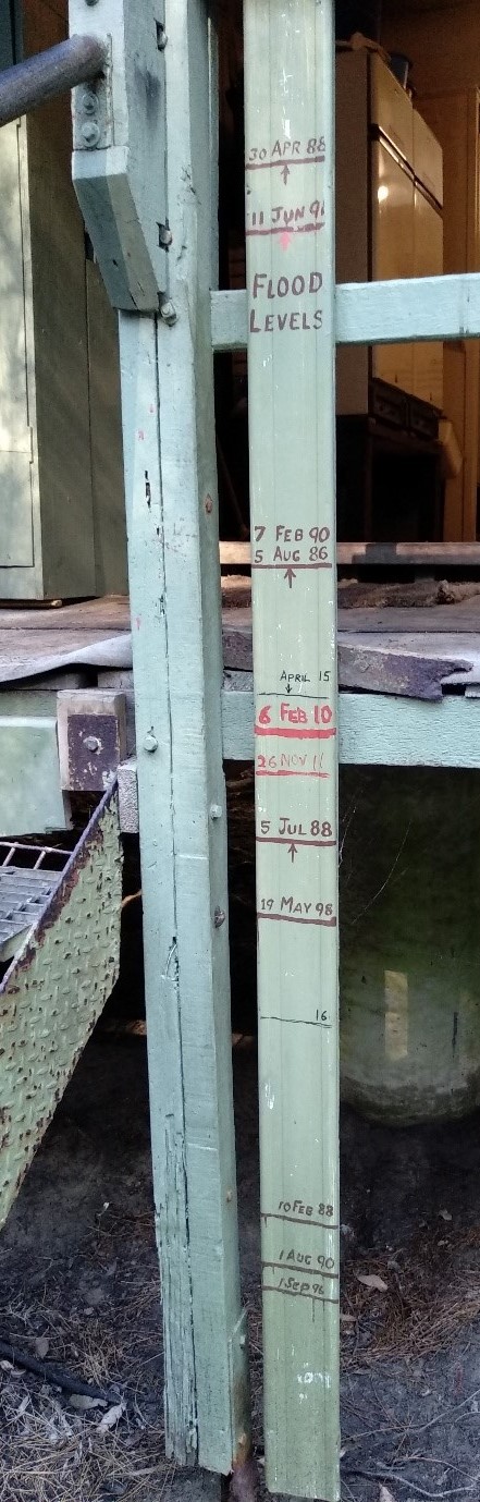
We are very lucky we haven't had floods like that in recent years, the recent floods have been recorded on the verandah post outside the kitchen door of the cub hut - Something to look for next time your at the Frank Windeyer Memorial Scout Camp!
Researched and written by James Burton, 1st Boronia Scout, July 2018.